Reburn Overlap and Canopy Recovery Across Two Kabylie Fires, 2021 and 2023
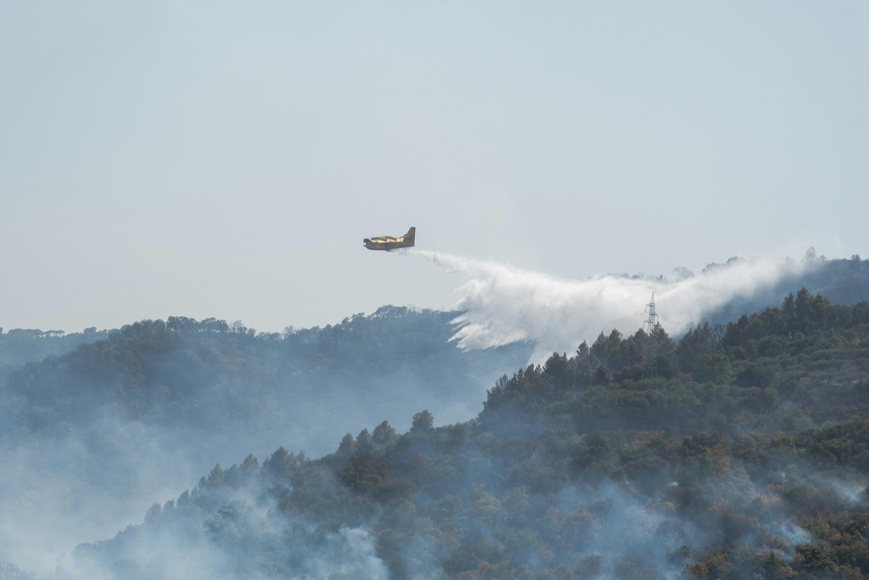
Burn extent, reburn overlap and four-summer canopy recovery for the 2021 and 2023 fires across 1,244 square kilometres of the Béjaïa coast, from eight archive scenes.

- Location
- Béjaïa and Tizi Ouzou, Kabylie, Algeria
- Area
- 1,244 km² analysed
- Record
- Fires of August 2021 and July 2023, recovery to August 2025
- Deliverables
- Burn extent per fire, reburn overlap, annual recovery series against unburned ground
The problem
Two catastrophic fires burned the same Béjaïa coast in 2021 and 2023, with no published recovery series, reburn analysis or comparison between them.
What we did
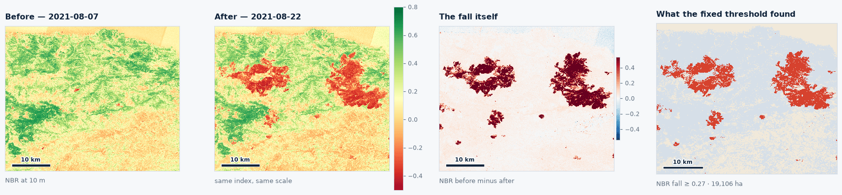
Each fire scored against the summer before it at the published Key and Benson break, five anniversary scenes on one orbit, and recovery measured against 75,151 hectares of unburned ground in the same scene.
The result
Two fires of almost identical size sharing 334 hectares, and the 2021 scar indistinguishable from unburned forest in four summers.
The Objective
Insurers, development banks and compensation programmes covering the Kabylie hills require two answers after a fire: how long the ground takes to recover, and whether the next fire will burn the same place. Fire burned the Béjaïa coast in August 2021 and again in July 2023. The 2021 fires were the worst Algeria had recorded in more than a decade, 100,101 hectares nationally by the forestry directorate’s count, and more than a third of the Algerian total was fig and olive. The published record for this terrain covers extent and severity in the weeks after each fire, with no recovery time series, reburn analysis or comparison between the two events.
Study Area and Scene Design
The analysis covers 1,244 square kilometres straddling Béjaïa and Tizi Ouzou: the Adekar, Akfadou and Toudja massifs, and Beni K’sila. The box was drawn once and held fixed across both analyses.
- 2021 fire: 7 August 2021 against 22 August 2021.
- 2023 fire: 20 July 2023 against 22 August 2023.
- Recovery series: 22 August 2021, 2022 and 2023, then 21 August 2024 and 2025, each 365 days from the last on the same relative orbit.
- Controls: August 2020 against 7 August 2021, and August 2022 against July 2023.
Each fire is scored against the summer before it, so the older scar is never counted twice. Ground counts as burned where the normalised burn ratio falls past the published Key and Benson reference break, applied unchanged, over ground that carried vegetation beforehand. Ground that burned in both fires is removed before either recovery trajectory is computed.
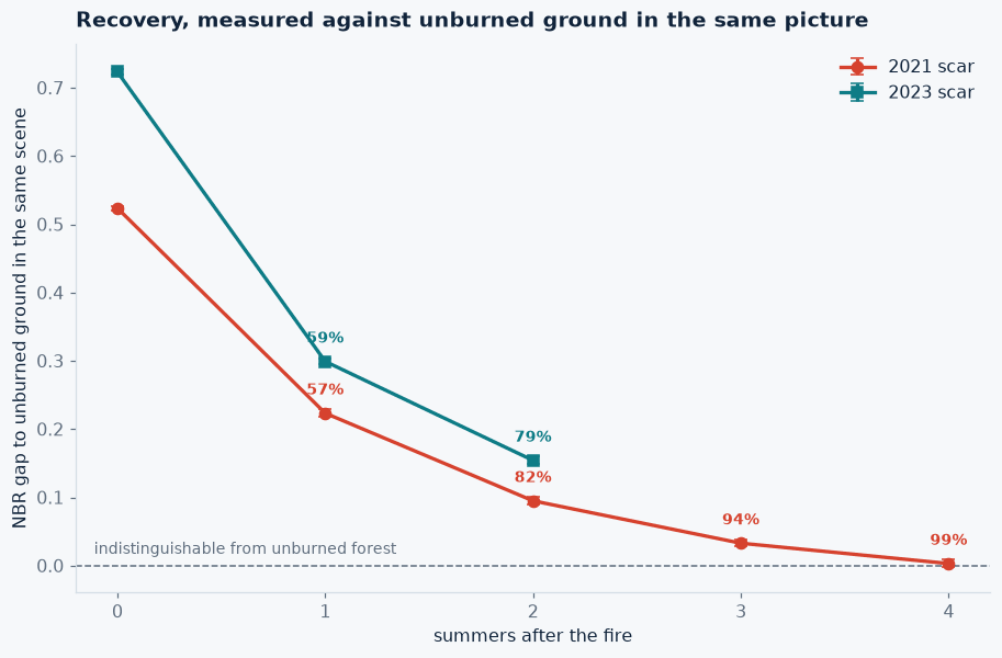
Recovery is measured against the 75,151 hectares that carried vegetation before both fires and burned in neither. Each year the system records the gap between the median burn ratio inside a scar and outside it, in the same scene on the same day, which removes rainfall year, phenology, sun angle and atmospheric correction from the comparison.
Burn Extent and Reburn Findings
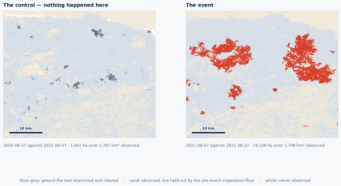
Both fires exceed their controls by more than an order of magnitude.
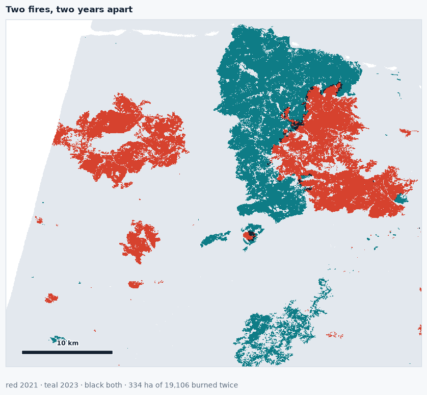
- August 2021 fire: 19,106 hectares burned, largest connected scar 10,009 hectares, control 1,841 hectares.
- July 2023 fire: 18,853 hectares burned, largest connected scar 15,603 hectares, control 489 hectares.
- Burned in both fires: 334 hectares, 1.9 per cent of the 2021 scar and 1.8 per cent of the 2023 scar.
- Median distance from the 2023 scar to the 2021 scar: 2,478 metres, against 2,192 metres for unburned ground.
- Share within 100 metres of the 2021 scar: 2.2 per cent for the 2023 scar, against 4.4 per cent for unburned ground.
For the 2023 fire, the UN Satellite Centre found about 18,000 hectares of burned vegetation over a 540 square kilometre window, and the European Forest Fire Information System recorded over 14,000 hectares in the Béjaïa region. Measured against the unburned pool, the 2021 scar neither drew the 2023 fire nor blocked it.
Canopy Recovery Findings
Each scar’s gap to unburned ground, by summers after the fire:
- Fire summer: 0.524 for the 2021 scar, 0.723 for the 2023 scar.
- One summer: 0.223 for 2021, 57 per cent closed; 0.299 for 2023, 59 per cent closed.
- Two summers: 0.095 for 2021, 82 per cent closed; 0.154 for 2023, 79 per cent closed.
- Three summers: 0.033 for 2021, 94 per cent closed.
- Four summers: 0.003 for 2021, 99 per cent closed, with a 95 per cent interval of -0.003 to +0.009 that contains zero.
At four summers the canopy signal over the 2021 scar is no longer separable from forest that never burned, within published Mediterranean recovery times, which run from about two years in northwest Spain to nearly six in Catalonia. The 2023 fire burned 38 per cent deeper and closes the same proportion of its gap each year. A vegetation index series over the same scars returns 47, 79, 91 and 98 per cent for 2021 and 55 and 77 for 2023, agreeing with the burn ratio to within two points.
Operational Utility
Insurers and development banks pricing this ground read the reburn result directly: two catastrophic fires in the same massif two years apart shared 1.9 per cent of their area, and the older scar carried no measurable protective effect, established from eight archive scenes without a field campaign. Compensation programmes set the duration of replanting support against the four-summer recovery of a burn of this severity. The record measures canopy signal against unburned ground; species composition and orchard production are confirmed in the field.
Run this on your own ground
Draw an area of interest, pick the dates, and the same analysis runs against the archive over your sites.
References
- Direction Générale des Forêts, national burned area statistics for 2021.
- European Forest Fire Information System, Joint Research Centre, annual reports 2021 and 2023.
- UN Satellite Centre, product 3644, Béjaïa wildfire delineation, 25 July 2023.
- International Charter Space and Major Disasters, activation 831, requested by the Algerian civil protection, July 2023.
- Conseil National des Assurances, agricultural risks branch statistics, 2020 and 2021.
- Key C.H. and Benson N.C. (2006). Landscape assessment: sampling and analysis methods. FIREMON, USDA Forest Service RMRS-GTR-164-CD.
- Companion study: mapping the Jasper burn scar, where the same threshold is scored against Canada's National Burned Area Composite.
More case studies
Storm Johannes Stand Ranking From Sentinel-1 and Sentinel-2 Across 323 Swedish Conifer Stands
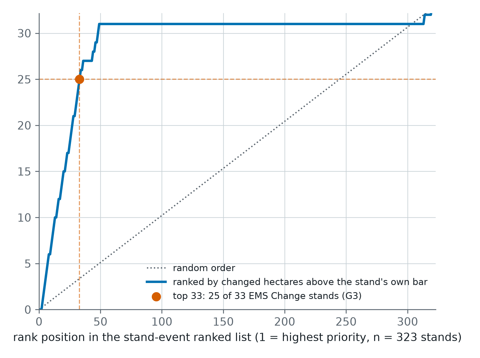
A post-storm ranking of 323 one-hectare conifer stands in central Sweden, each read from Sentinel-1 and Sentinel-2 against its own quiet years and scored against Copernicus EMS grading.
Forty-Three Seasons of a Nebraska Pivot and Management Zone Delineation
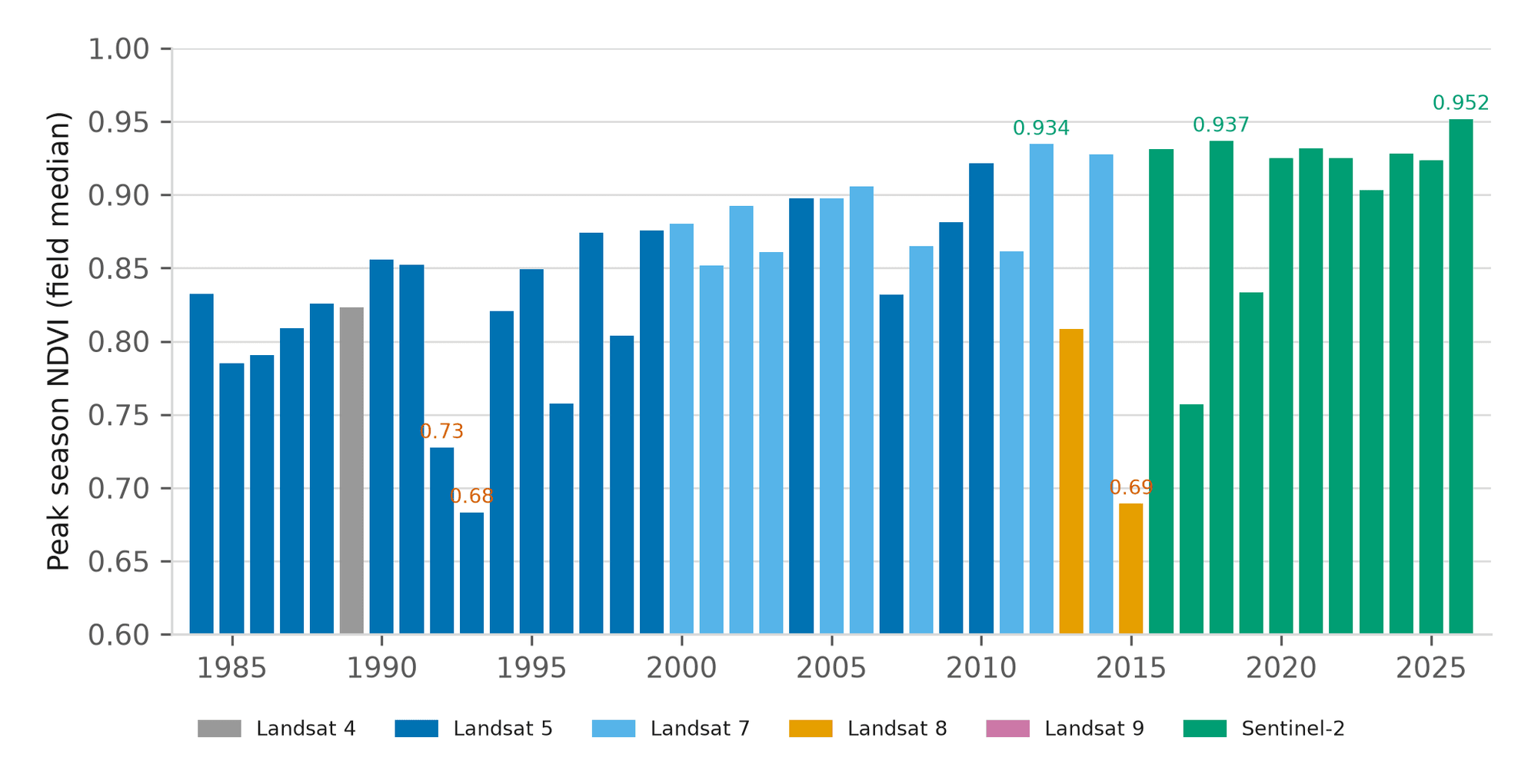
A 43-year canopy baseline for one centre pivot near Seward, Nebraska, and a three-tier management zone map built from vegetation, terrain and radar moisture.
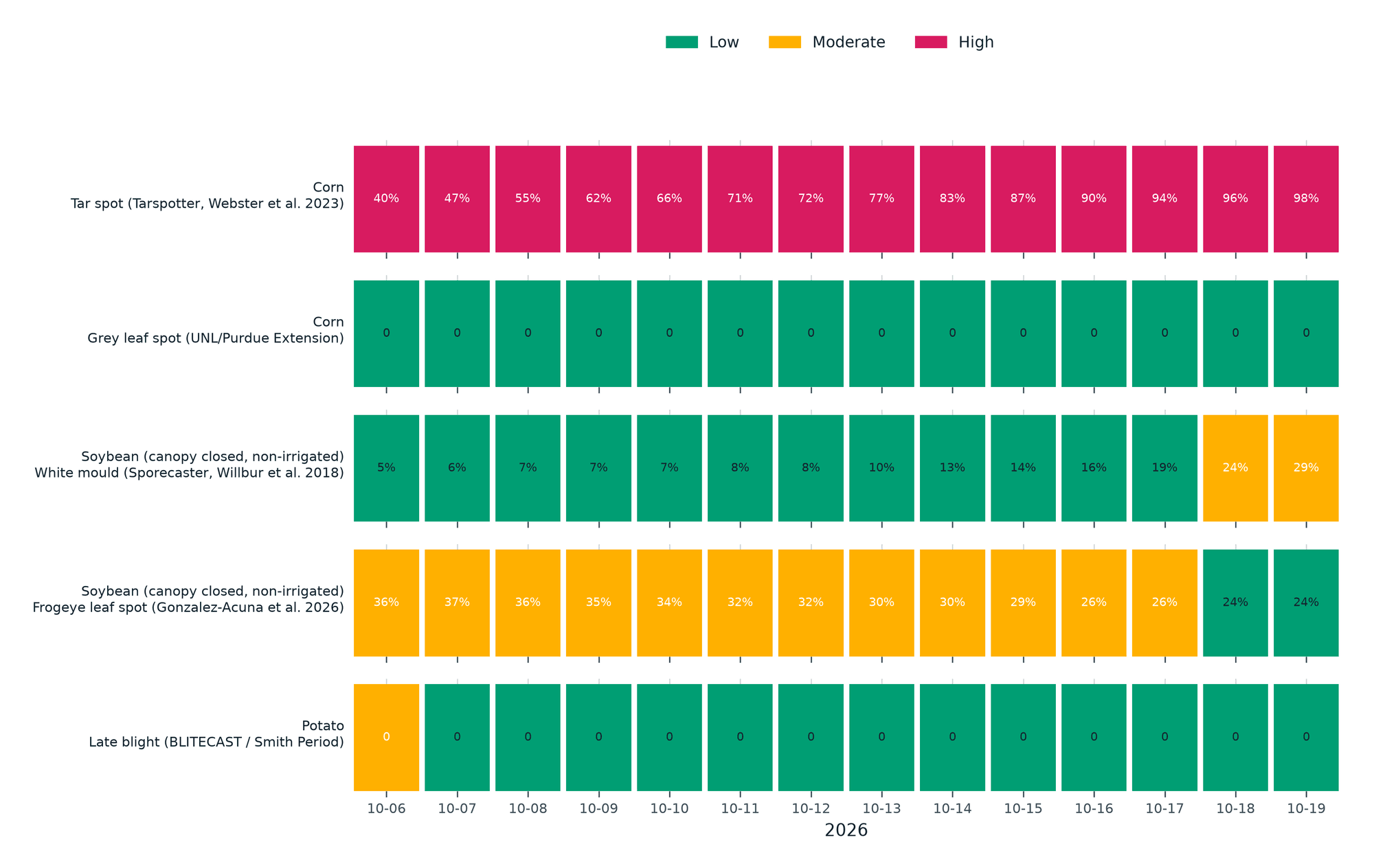
Season Brief and Fourteen-Day Disease Forecast for a Kansas Corn Pivot
A 184-day season brief for a 61-hectare corn pivot in western Kansas against its own 10-year normal, with five published disease models run on the field's own 14-day forecast.