蚀变矿物填图
圈定您的矿权区,获得分类蚀变图:高级泥化、绢英岩化与青磐岩化,逐像元解析。
逐像元蚀变矿物学,区分高级泥化、绢英岩化与青磐岩化组合。
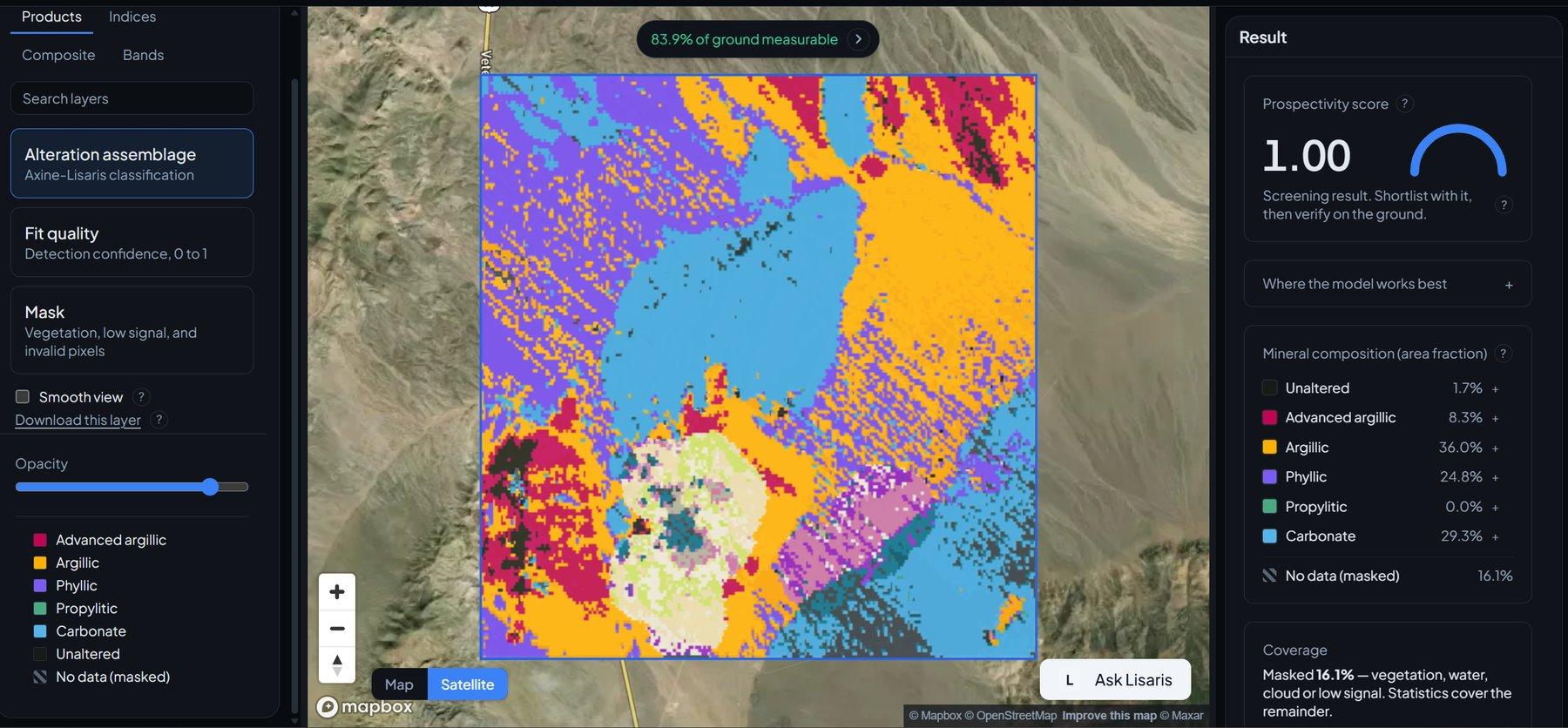
A historic mining district in Nevada. Continuum-removed alteration assemblage: advanced argillic (alunite, pyrophyllite) against phyllic (illite, muscovite).
传感器看到什么
这个图层在寻找什么。
每种材料的实验室参考光谱,以及传感器波段间隔能捕捉到的部分。阴影区标示方法读取的范围。
它能发现什么
它检测什么。
| 材料 | 典型产出环境 | 可能的混淆因素 |
|---|---|---|
| Alunite & Pyrophyllite | High-sulfidation epithermal lithocaps and porphyry cores | Strong atmospheric water vapour at the edge of the window |
| Kaolinite & Dickite | Intermediate argillic alteration and weathering horizons | Poorly crystalline smectite clay mixtures |
| Illite & Muscovite (White Mica) | Phyllic alteration shells in porphyry Cu-Mo-Au systems | Dry canopy cellulose, which overlaps the same range |
| Chlorite & Epidote | Distal propylitic alteration haloes | Calcite and dolomite carbonate absorptions |
方法
工作原理。
输入校准反射率,每个像元都对照公开参考库进行拟合。
Surface reflectance ingest
Scenes are read at the archive's own surface reflectance level. Wherever the instrument measured nothing, that gap is declared and carried through, never interpolated across.
Continuum removal
A convex upper hull is fitted across the working range so the shape of each absorption stands apart from overall brightness.
Least-squares fitting against reference spectra
Continuum-removed features are fitted to laboratory reference spectra using non-negative least squares with wavelength shift.
Evaluability masking
Green canopy, cloud, shadow and low-illumination pixels go into a separate "not evaluated" class, hatched in the legend, transparent on the map, null in exports. Not measured is drawn differently from measured zero.
技术规格
您得到什么,它在什么数据上运行。
所需环境条件
Method and checks are documented in Axine Applied Spectroscopy Paper #1 · Section 4.2.
适用边界
Reads exposed rock and soil. Vegetated and covered ground is masked out, and nothing here speaks to what lies at depth.