
Field register and weekly record
Every field on the register gets the clearest Sentinel-2 look of the week, read against the same weeks of its own earlier seasons. Each field is marked steady, moved or no clear look, so your agronomists drive to the fields that changed.
For agronomy leads at independent retailers and co-ops, crop consultants, crop insurers’ claims teams and agricultural lenders.
- Cadence
- Weekly
- Coverage
- Conterminous United States
- Billed by
- Hectare
- Delivered as
- Register, PDF, API
01 · The order
What you send, and what comes back
You send
- Field boundaries, drawn or uploaded
- The crop, where you know it
You receive
- A row per field per week: the clearest look, the field’s own range, and a plain-word status
- Daily rain and temperature for each field, with growing degree days for its crop, beside the same dates last season
- Crop type per field and season, with its public source named
- A field record PDF with the season, the history back to 1984 and every scene named
- Candidate boundaries for an area, accepted one by one into the register
02 · How it is read
From the open archive to the record
Public sources
- 01
A season is read against the field’s own earlier seasons, not a regional average, so a field that is always late is not flagged for being late.
- 02
It is a record of the imagery, not a diagnosis. The agronomist decides what a moved field means.
- 03
Weather and the free record cover the conterminous United States.
More in Agriculture
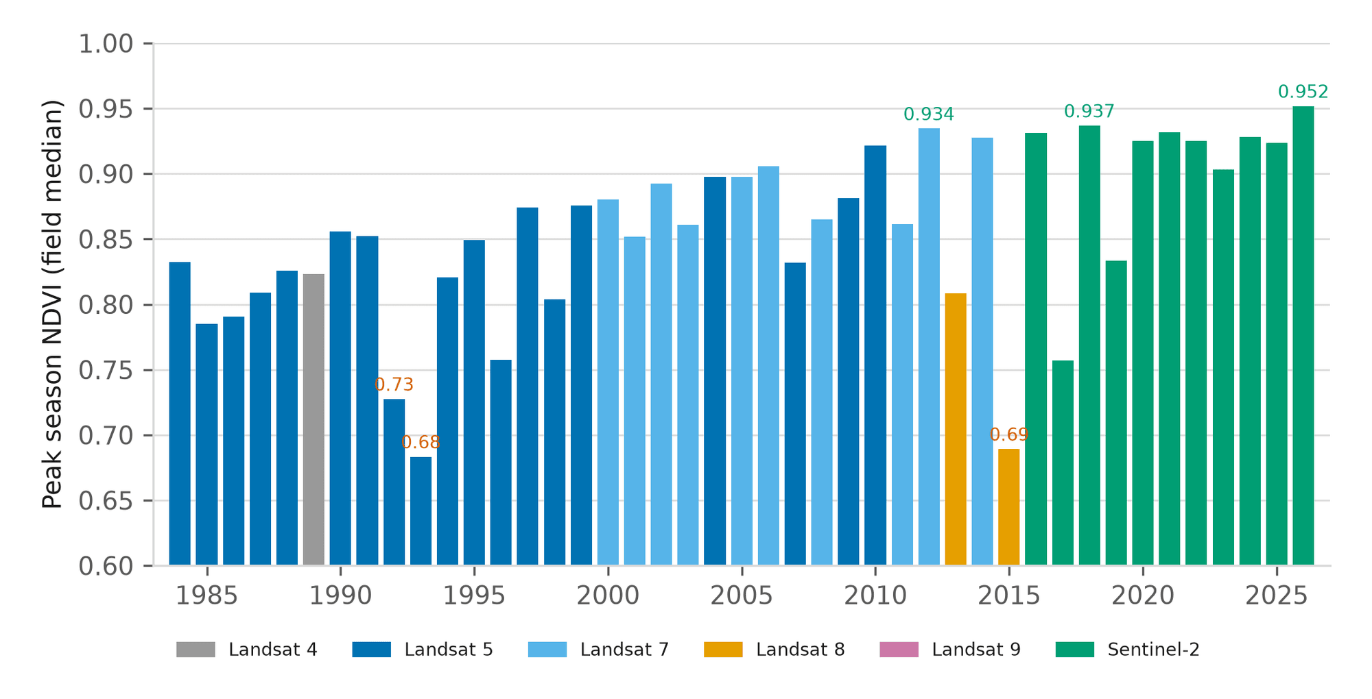
43-year field history
One bar a year for every field since 1984, each naming its sensor, with the field’s highest and lowest seasons.
Management zones
Split a field into three to five zones from its own last several seasons, and attach a rate per zone for export.
Scouting app
The field register on a phone: this week’s status, tasks and photos pinned to the field, and work that keeps going offline.
White label editions
The field record under your own name, with a workspace for each grower you serve and every record issued by you.
Crop classification
What crop stood on an area in a season, as a map and as parcels, with your own field truth taking precedence where you have it.
Land cover classification
An area classified into ESA WorldCover classes for a chosen season, and what changed between two periods.
Send us twenty fields
Send twenty field boundaries. The record comes back within 48 hours as a PDF with the layers, and the rest of your book can run under your own name.