SECTOR PROFILE · MINING & EXPLORATION
Alteration mapping, without the airborne survey.
Draw your licence area and get back classified alteration zones, a district ranking, and a vector toward the hydrothermal centre. Fitting runs against a public laboratory spectral library.

What people bring us, and how we handle it.
Telling alunite, kaolinite and illite apart
Broadband sensors blend all three into one clay index, so the zonation you came for disappears.
Hyperspectral measurement keeps the three clay signatures apart, so you get the zoning instead of an average.
Vectoring toward the porphyry centre
Picking up the white mica composition shift normally means a dense, destructive core sampling programme.
White mica chemistry shifts steadily from the centre of a system to its fringe, and that gradient maps straight from orbit.
Real gossan against ordinary iron staining
In true-colour imagery, a gossan over economic sulfides and barren iron staining look the same.
Hematite and goethite separate on where the absorption sits. The iron-hydroxyl reading is carried alongside as a ferric class, with its scope measured against the public mineral reference library.
Covering a whole belt before you commit
An airborne hyperspectral survey has to be commissioned, permitted and flown, which puts it out of reach on early-stage ground.
Belt-scale screening runs from orbit the day you sign in. Imagery access is never charged for: a plan buys the models, and an order buys imagery we procure.
WORKED EXAMPLE
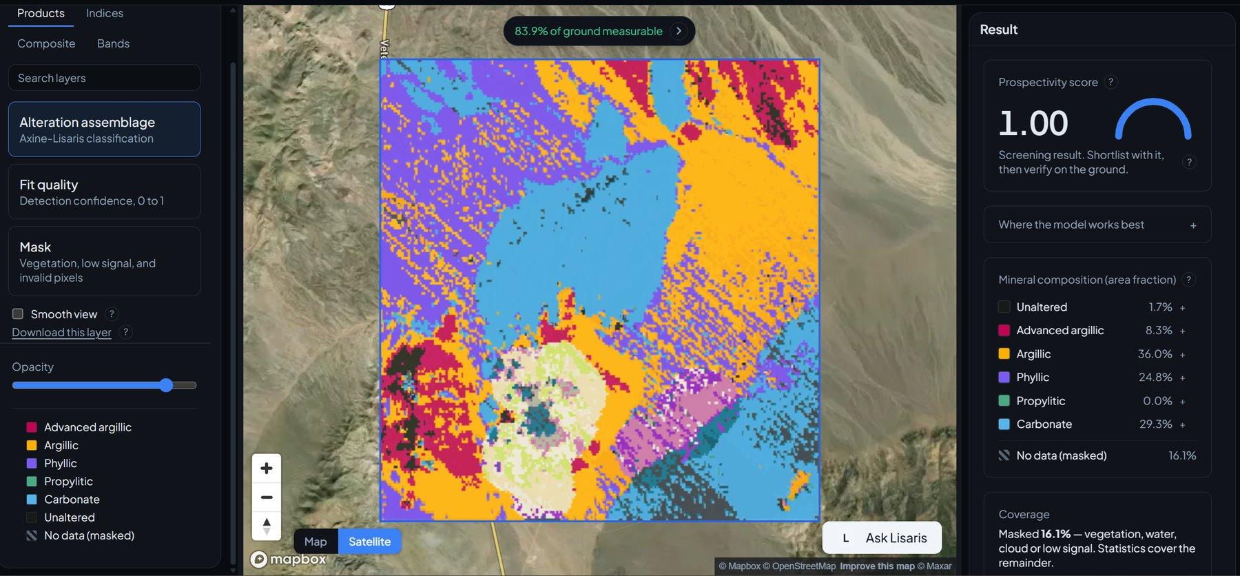
Case study: Alteration benchmark over a historic Nevada district
This district is the site everyone benchmarks against, so it is where we run ours. An independent expert-system classifier runs end to end here, on scenes from the archive.
Surface reflectance ingest
Scenes come in at the archive’s own surface reflectance level. Where the instrument measures nothing, we say so instead of interpolating across the gap.
Continuum removal
A continuum baseline is fitted across the shortwave infrared, so absorption depth can be read on its own.
Least-squares fitting against reference spectra
Non-negative least squares against alunite, kaolinite and muscovite endmembers from the public library.
What you get back
Cloud-Optimized GeoTIFF mineral maps, GeoJSON alteration clusters, and a record naming the engine, the model version and the scenes behind every layer.

APPLICABLE SOLUTIONS
Layers that fit this sector.
Ready to run over your area, with no configuration step in between.
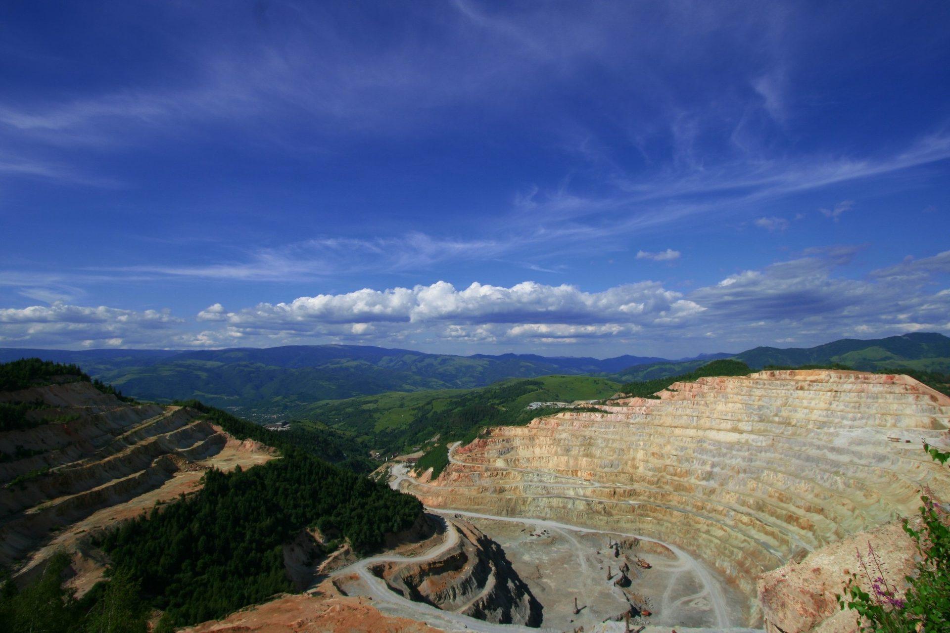
Alteration Mineral Mapping
Per-pixel alteration mineralogy separating advanced argillic, phyllic and propylitic assemblages.

District Prospectivity Ranking
Regional likelihood scoring for hydrothermal systems, backed by leave-one-region-out cross-validation.

Alteration Cluster Detection
Vectorised clustering that pulls out the core hydrothermal hubs and the nodes worth working outward from.

Lithium Pegmatite Index
Maps lithium-bearing mica by how its signature differs from ordinary white mica.

Gossan & Iron Oxide Speciation
Separates hematite from goethite, and reports the related iron-hydroxyl reading as a ferric class.

Porphyry Cu-Au Vectoring
Vectors toward the hydrothermal centre by tracking how white mica composition shifts across the district.
APPLIED SPECTROSCOPY SERIES
Read the method in full.
The unmixing equations, the error propagation, and the validation behind each layer, written out for your own review.
The Spectral Advantage in Mineral Exploration
Methodology for orbital continuum removal, library fitting against public reference spectra, and field validation across the Nevada and Utah alteration districts.

FREQUENTLY ASKED QUESTIONS
Questions we get asked about this sector.
RUN IT OVER YOUR GROUND
Run this over your Mineral Exploration area.
Order processing over your area, or a dedicated capture where the archive has nothing usable. Ask Lisaris in plain language to take the area, run the pipeline and tell you when the layers are ready.