
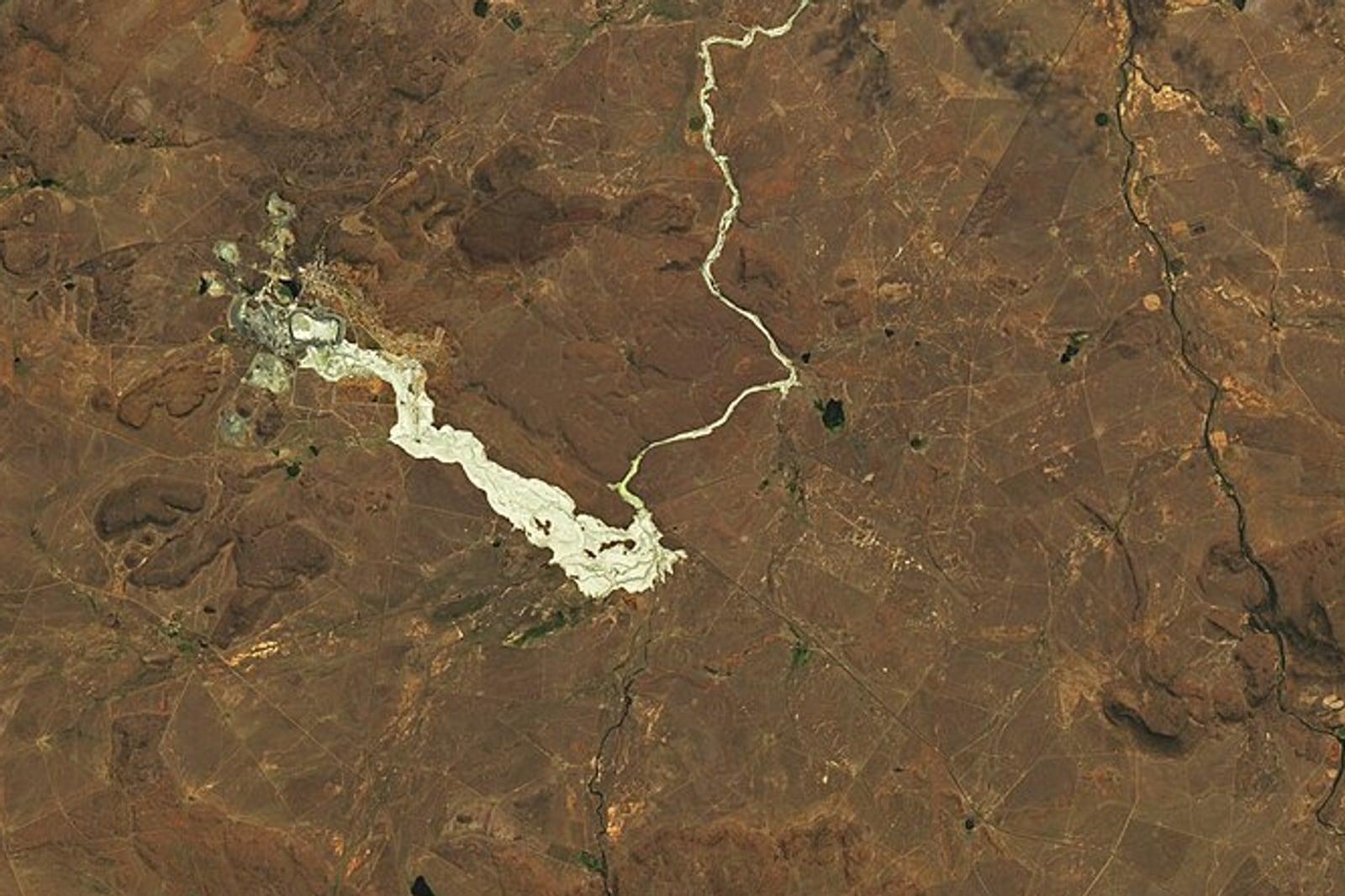
Tailings and Acid Drainage Screening
Available on requestMap surface moisture and sulfate efflorescence on tailings embankments and track secondary iron coatings in the drainage below. Exposed faces and crests are differenced against a dry-date baseline, isolating any face that has turned wet. Along downstream channels, iron and sulfate coatings on beds and banks are mapped as a ferric class, reach by reach. Both scenes and the offset applied between them are documented in the final output.
Built for tailings engineers tracking exposed faces, environment teams directing water sampling, and the teams accountable to regulators and downstream communities.
Core Capabilities
Baseline Differencing
Embankment faces are differenced against a dry date to isolate change in moisture and sulfate.
Reach-Level Mapping
Coatings along the drainage are mapped reach by reach, so water sampling starts where they appear.
Checked Outputs
An entirely empty difference raises an error rather than passing as no change.
Inputs and Deliverables
Inputs Required
- Facility footprint and the drainage to be read (GeoJSON, zipped shapefile, or KML).
- A trusted dry date for the baseline, where available (our team will locate one in the archive otherwise).
Deliverables
- Embankment zones with moisture or sulfate change since the baseline, as GeoTIFF and GeoJSON polygons.
- GeoJSON flowlines marking drainage reaches with precipitate coatings.
- Cloud-Optimized GeoTIFF ferric class layer along each channel.
- Provenance record specifying both scenes, methodology version, and the offset applied.
Methodology and Sources
Public Sources: Open spaceborne hyperspectral archive, Public mineral reference library.
Commercial Sources: High-resolution imagery via our partner SkyFi (on request).
Limits of Detection
Analysis is limited to exposed embankment faces and channel surfaces. Pore pressure, the phreatic surface, dam stability, pH, and dissolved metals are not measured.
The dry baseline anchors the comparison, and the record names the date used. A difference that returns entirely empty raises an error and is never reported as no change.
Coatings are reported as a ferric class rather than a single named sulfate, because several minerals that pass the same gate are common at copper mines. The mapped reaches direct water sampling to the channels with visible coatings.
Workflow
Submit Boundaries
Provide the facility footprint and the drainage network to be read.
Baseline Selection
Specify a trusted dry date, or we identify one in the archive.
Differencing and Tracing
Embankment faces are differenced against the baseline, and downstream channels are read for coatings.
Delivery
You receive the zone polygons, flowlines, ferric class layer, and provenance documentation.
Use Cases
Mine Operators
Give tailings engineers a dated record of the exposed faces between inspections.
ESG and Closure Teams
Direct water sampling to coated reaches and maintain a record of them through closure.
Investors and Lenders
Review the faces and drainage of a facility on scenes that can be independently traced.
Related Solutions
Mine Footprint and Disturbance
Map and quantify ground disturbance across open pits, waste rock dumps and tailings boundaries between any two dates.
Gossan and Iron Oxide Mapping
Separate hematite from goethite across your ground and map ferric hydroxyl coatings as a distinct class.
Methane Screening Near Operations
Outline point-source methane plumes over designated facilities using hyperspectral archives.
Submit a Licence Area
Provide the boundary of one licence or one belt. Our team runs the alteration map and the district score over it and reviews the results with your geologists.